Have you ever wondered where the centre of a city is? Where do those milestones you see on a highway which tend to (->) 0 actually reach 0? How does GPS measure distances? Well, I took it upon myself to find out!
What other city than our Bangalore? namma Bengaluru?
I wanted to figure out where the centre of Bangalore / Bengaluru is! I searched for Google for the Lat/ Long Co-ordinates of this great city – this is what I found
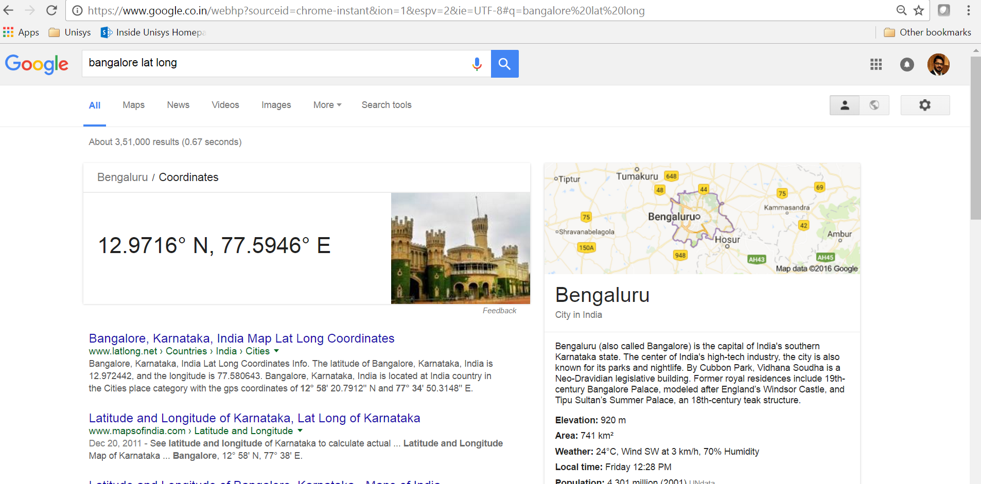
Brilliant, so she is at a Latitude of 12.9716 and a Longitude of 77.5946.
Now, let us Plot!
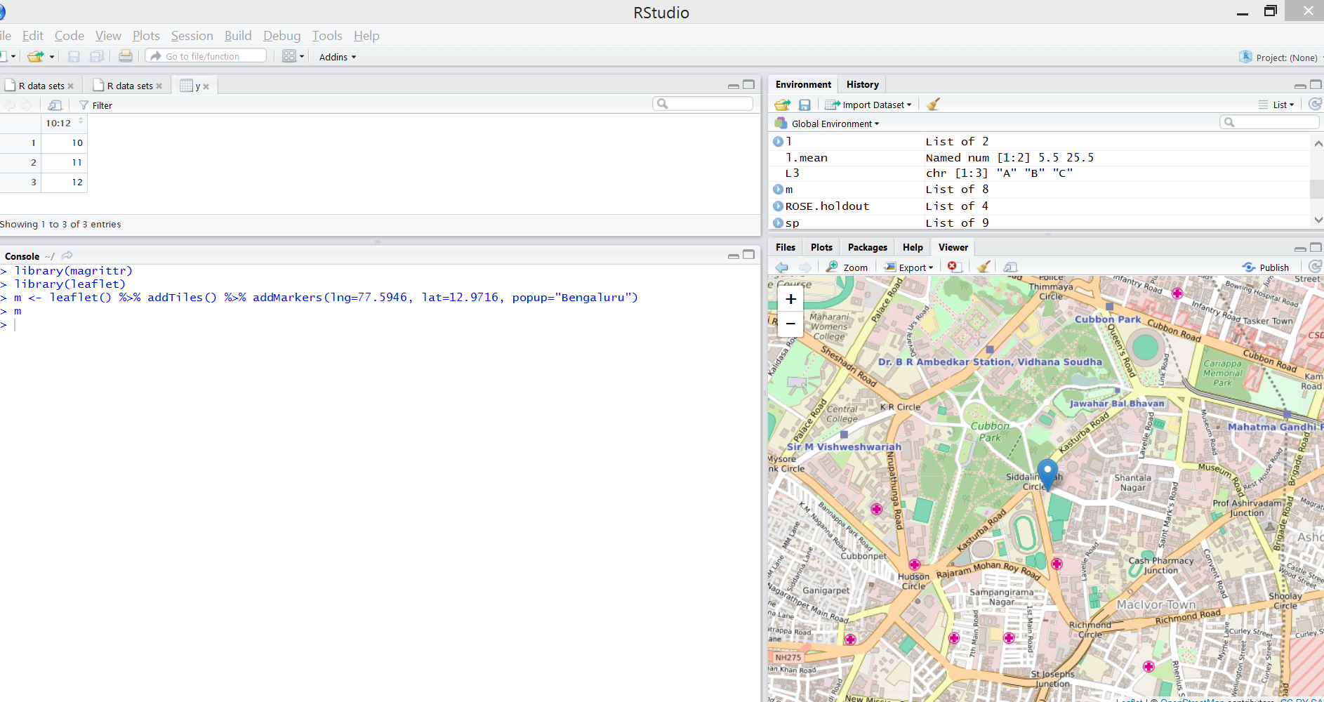
I am using the map visualization package called ‘leaflet’ to plot. More details on this package at this link.
It is not a lot of code to plot using the leaflet package, a snapshot of RStudio with the code and the generated plot below –
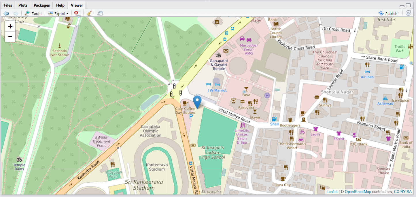
Look at the location, are you surprised? Well, I was. I was expecting it to be at the junction of old city (Chickpet) or some place near City Market or Chamarajpet!
If someone from the future were to communicate to you (from another dimension using say Gravity 🙂 Interstellar style) and ask you to be in the centre of Bangalore, now you know where to wait! You just need to know when!